R.Reiss rectangular protractor survey map scale rules set in box 1925 Germany
€145.00
R.Reiss rectangular protractor survey map and scale ruler set in wooden box, made ca 1925 in Germany
1 in stock
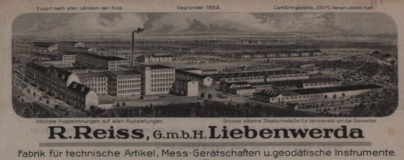
The R.Reiss company was founded in 1882 in the village of Liebenwerda in Germany. The founder named Herman Robert Reiss started out as retailer of scientific measuring instrument but after several years started fabricating his own instruments as well. The below advertisement is from the early 1920’s.

R.Reiss presented itself in the 1920’s a factory of technical items, measuring tools and geodatic instruments. After WWII the company was part of Eastern-Germany (GDR) and stopped making (geodetic) instruments in 1949.
So this high quality antique tool for map measuring purposes was made in the same period. It was purchased by a the German landmeter / surveyor instate of Germany, city of Pirna. It consists of 3 heavy metal (plated brass) with 1 or 2 metal knobs for handling. The long ruler can form a T-square for determining your area and the rectangular protractor (early romer) help find the grid reference. They only worked with the then standard 1:1000 and 1:2000 scale for building maps. So a very specific piece of kit that was well treated and always kept in it’s dedicated box. While well protected, there are clear signs of use, which I think only adds to it’s history. The case is in great shape but the green very is deteriorating. The R.Reiss-logo on the rule is clearly visible as is the stamp inside the box lid. The case measures about 40 cm or 16 inches wide. Check the attached video on how to work this vintage man tool: area and grid reference instructions!


